El Caminito del Rey It wasn’t built for walking. It began as a service road for a hydroelectric power station, and its history begins by rail.
The Córdoba–Málaga line was completed in 1866, and to build it, it was necessary to cross the Gaitanes Gorge.
And when it was opened, something was discovered: The Guadalhorce River entered the gorge at one elevation and emerged at a very different one. That natural gradient made the place an ideal spot for a large hydroelectric power station.
Nobody was looking for that. They found it whilst building a railway line.
The railway concession was held by Jorge Loring, 1st Marquess of the House of Loring, from a family originally from Boston based in Málaga.
Loring was also awarded the hydroelectric concession, but never went on to operate it. The person who took charge was Rafael Benjumea Burín, engineer related to the Loring family by marriage.
At 1903 the … is founded Sociedad Hidroeléctrica del Chorro, Spain’s second-largest hydroelectric company.
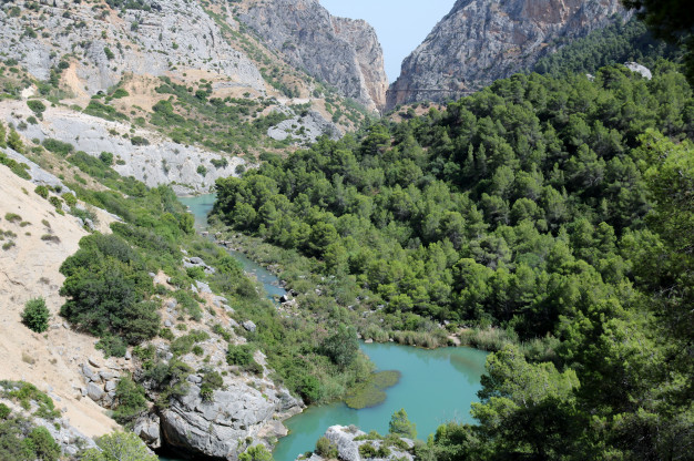
The practical problem was as follows: The company had two waterfalls, the one at the Gaitanejo and that of El Chorro, separated by a gorge with vertical walls. Workers were needed to go back and forth, as well as materials and security for the canal.
Construction began in 1901 and was completed in 1905. The path began next to the railway tracks and wound its way through the gorge.
Benjumea hired sailors, and it makes perfect sense: they were the only ones used to working suspended by ropes at great heights, as in the rigging of a ship.
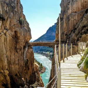
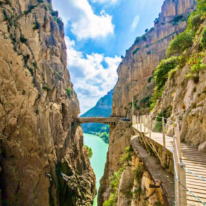
What they built was a path made of wooden planks, less than a metre wide, attached to the wall. No concrete yet.
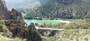
In 1907, Málaga suffered a major flood, coupled with a massive economic disaster. That was one of the two reasons behind the construction of the reservoir: to regulate the river and, at the same time, achieve self-sufficiency in electricity in the province, which until then had been run by foreign companies.
The reservoir was built between 1914 and 1921, and in those years the path became popular: people would climb up there friends and family of the chief engineer, other engineers and members of the public.
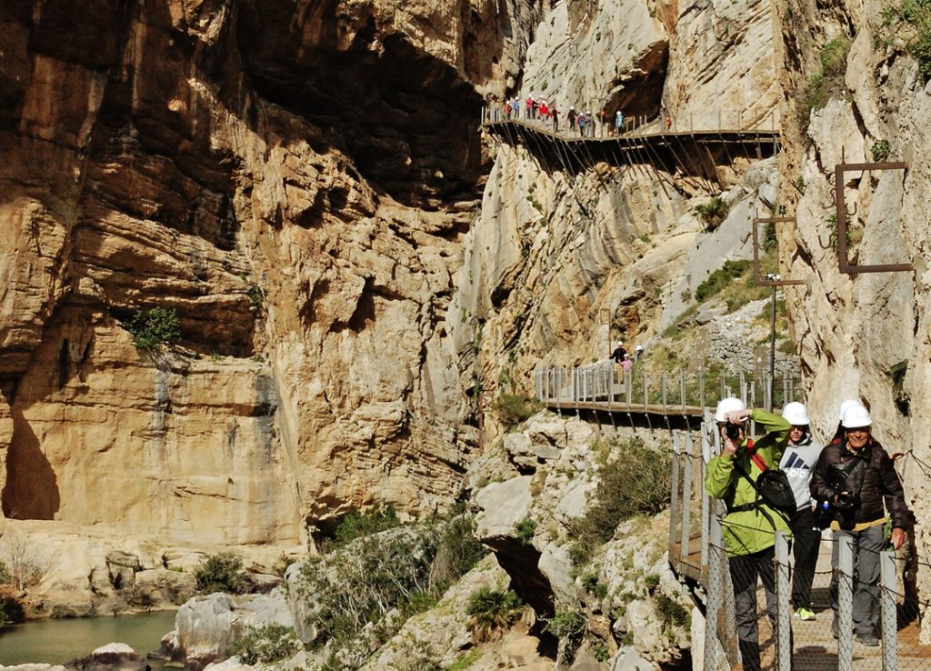
This is the fact that explains what you see today beneath the catwalks.
At 1919, with the King’s visit already scheduled, Benjumea replaced the wooden plank platform with a concrete one.
In other words: The concrete path that can be seen hanging beneath the current footbridge is not the original one from 1905. It is the one built in 1919 to allow Alfonso XIII to pass through.
21 May 1921, Alfonso XIII went to lay the final stone at the dam. He signed the document whilst seated at a set of carved stone tables and chairs that still stands there: The King’s Throne.
And a sense of honesty that is worth upholding: It is said that the monarch did not dare to travel the whole way. But all it took was for me to step on it: the locals began to call it «the King’s Path», and the name stuck.
The circle closes in September: on 12 September 1921 The king appointed Benjumea Count of Guadalhorce. He would later become Minister of Public Works. And The reservoir was given its name in 1953.
The points along the route, in What to see at the Caminito del Rey.
Once the building work is complete, the Caminito became part of everyday life in the region. It was used by the residents of El Chorro and the surrounding area to cross the gorge: it was their everyday shortcut.
Until it could no longer be maintained.
The concrete began to crack. Then sections without a floor, where only the steel girder spanning the void, with no handrail or anything to hold on to.
And yet people were still passing by. El Chorro is one of Europe’s most important climbing areas, and the Caminito became a magnet for those seeking a thrill.
Between 1999 and 2000, four hikers died. The Regional Government of Andalusia blocked the way and he demolished the opening section to physically prevent entry.
That is where its reputation as the «world’s most dangerous trail» comes from, although this is no longer the case. We explain this in Is the Caminito del Rey dangerous?.
In February 2014 the Malaga Provincial Council began the comprehensive restoration process.
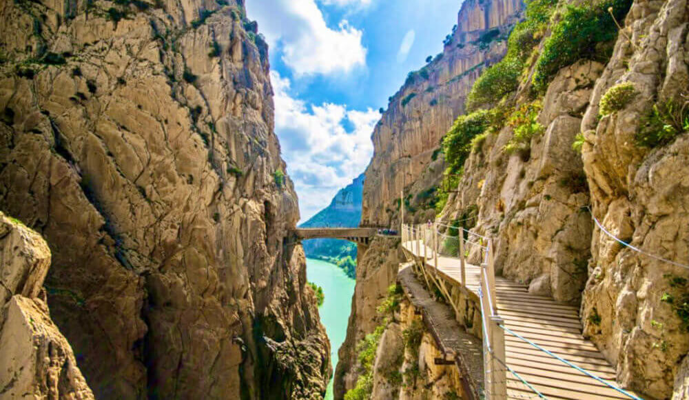
And a wise decision was made: Do not demolish the old structure. The wooden walkways were erected on top of a metal structure anchored to the rock, above the old road, which is still visible from above.
It reopened on 28 March 2015. Since then: a linear route, a continuous handrail, compulsory helmets and capacity limits by time slots.
And now he aims to UNESCO World Heritage as hydroelectric industrial heritage.
How to prepare it, in the recommendations; if you’re travelling with your family, with children; and for lunch, Where to eat in El Caminito.
We are a local tour operator based in Málaga with over 50 years’ experience organising tours around Andalusia. Our guides bring this history to life on the ground, pointing out exactly where everything is:
Guided tours are also available in German, French and Italian. The whole destination, in the Caminito del Rey.
Because Alfonso XIII walked along it on 21 May 1921, when he went to lay the cornerstone of the El Chorro dam. Following that visit, the locals began to call it «the King’s Path», and this popular name took precedence over its technical designation. It is said, however, that the monarch did not actually walk the whole length of it.
Between 1901 and 1905, it served as a service road for the Chorro Hydroelectric Company, which needed to link its two power stations – Gaitanejo and El Chorro – separated by the gorge. It was used for the passage of workers, the transport of materials and the monitoring of the canal. It served no tourist purpose.
Not exactly. The walkway from 1905 was a wooden plank platform. It was in 1919 that Rafael Benjumea replaced it with a concrete one, in anticipation of the planned royal visit. Therefore, the concrete structure that remains today beneath the current footbridges dates from that 1919 renovation, not the original construction.
The engineer Rafael Benjumea Burín led the project; he was related by marriage to the Loring family, who held the concession for the Córdoba–Málaga railway. To construct it, he hired sailors, as they were the only ones accustomed to working suspended by ropes at great heights. The developer was the Sociedad Hidroeléctrica del Chorro, founded in 1903 and the second of its kind in Spain.
Due to the deterioration of the structure, which left sections without a floor, with only the steel beam spanning the void. Even so, people continued to cross it, drawn by the thrill of the risk, and between 1999 and 2000 four hikers died. The Andalusian Regional Government closed off access and even demolished the initial section to physically prevent people from crossing.
On 28 March 2015, following a restoration project launched by Málaga Provincial Council in February 2014. The new footbridges were mounted on a metal structure anchored to the rock, above the old path, which was left exposed. The site is currently a candidate for UNESCO World Heritage status as a hydroelectric industrial heritage site.