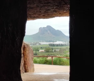
The Caminito del Rey is not just about footbridges. Along its 7.7 kilometres there are ten points worth noting, because if you don’t know what you’re looking at, you’ll walk right past half of it.
Van in the order in which you’ll come across them, from north to south.
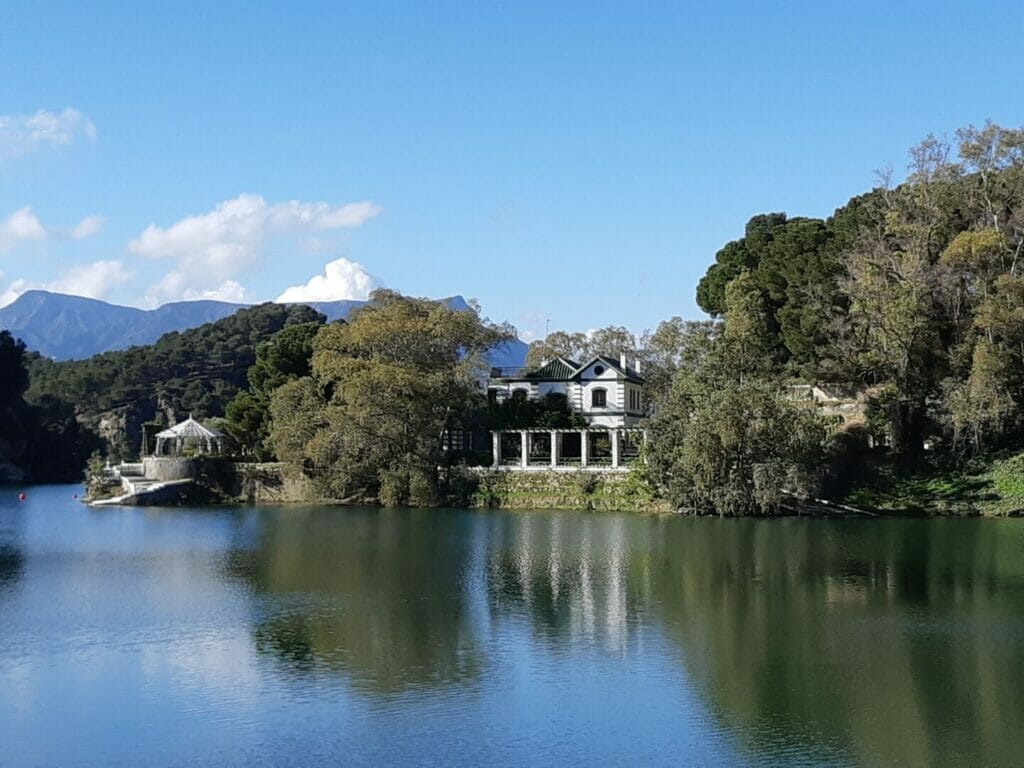
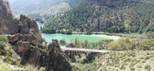
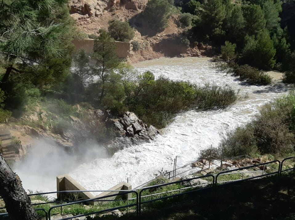
About 200 metres from the El Kiosko restaurant There is the dam. It was built between 1914 and 1921 under the supervision of the engineer Rafael Benjumea, so that we can make the most of three rivers together: Turón, Guadalhorce and Guadalteba.
And here’s the detail that almost nobody knows: the reservoir It wasn’t always called that. It was subsequently renamed «Conde de Guadalhorce» in 1953, in memory of its builder. Because Benjumea Alfonso XIII himself appointed him Count of Guadalhorce on 12 September 1921, four months after this dam was opened.
In other words: The reservoir is named after the title the king bestowed upon his engineer. Benjumea would eventually become Minister for Public Works in 1926.
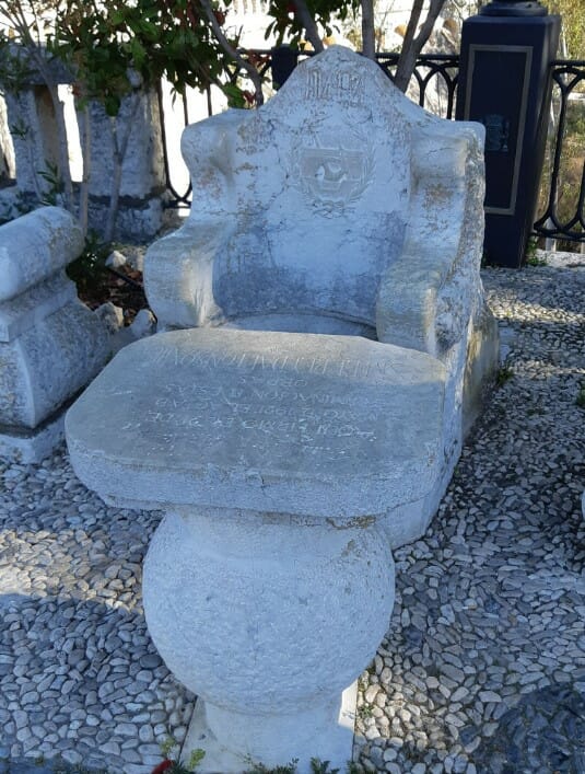
It is not a natural formation, although it is sometimes described that way. It is a set comprising a table, benches and an armchair, all carved from stone, made from the same stone as the reservoir and placed here on purpose.
What is it for: so that Alfonso XIII signed the certificate of completion of the works, the 21 May 1921. He did so in the pouring rain, after lunch.
And there’s a story behind it: during the Civil War they threw the group into the waters of the reservoir. Years later, it was recovered and returned to its original location. What you see today spent some time underwater.
It’s opposite the Engineer’s House, which Benjumea had built. It is not open to the public.
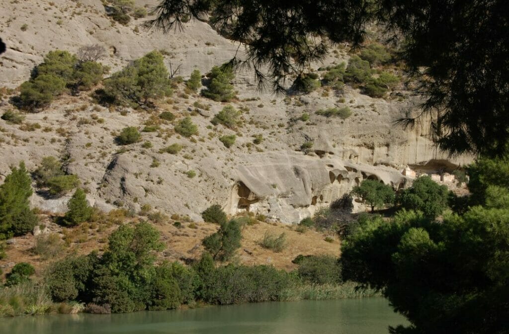
A short tunnel on the approach path. Tafonis are rounded cavities which erosion carves into the sandstone, and as you emerge from the tunnel you’ll see four caves formed in this way.
A brief guide: From the viewpoint at the Gaitanejo Dam, you can see the cave dwellings in Sierra Parda, which used to be accommodation for the hydroelectric power station staff. Look for them on the hillside.
This is the very reason for the Caminito’s existence. The road was built between 1901 and 1905 so that the workers could maintain the hydroelectric power station. It wasn’t built for a stroll.
And here’s an interesting fact about how it came about: Benjumea hired seamen to build it. They were the only ones used to working suspended from ropes at great heights.
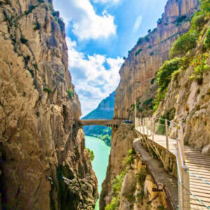
This is where the Gaitanejo Gorge, the first gorge, which narrows considerably at its narrowest points. The river lies at your feet.
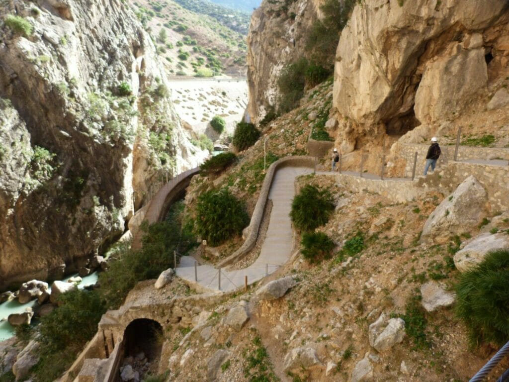
After the first kilometre, the gorge opens out and You go down to the river via some concrete steps which are so called because of their shape and colour. A small tunnel lies ahead.
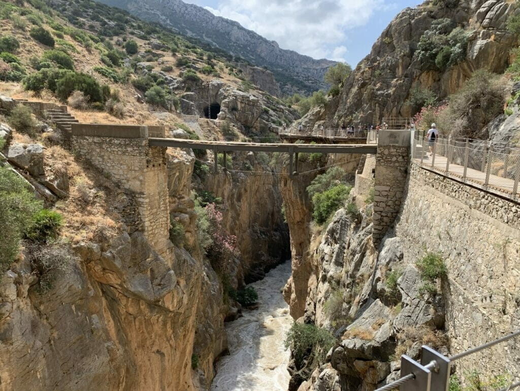
The king passed this way on his way out. Alfonso XIII travelled through it in order to take the train which is right opposite, and bring their visit to an end.
Two more things to look at at this stage: on Talud Viewpoint, next to the track, and the Toro Cave, which the blacksmiths used whilst installing the original walkway.
An honest observation about the king: It is said that he didn’t manage to walk the whole way. It was that visit that led the locals to name it «the King’s Path». The full story can be found at The origins of the Caminito del Rey.
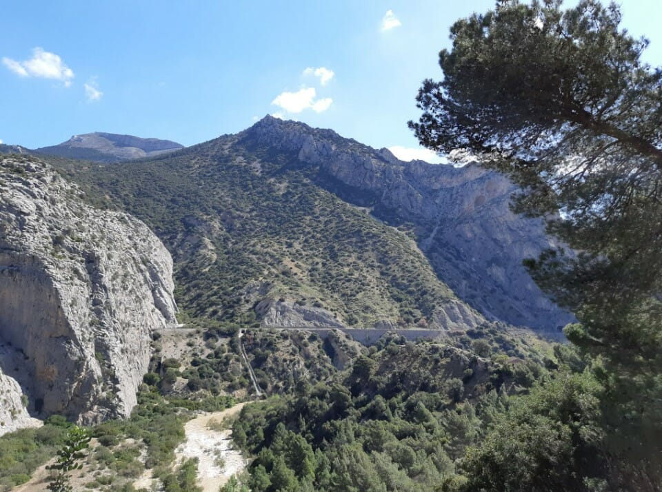
A breather on the journey. One and a half kilometres from the northern entrance, between the two gorges, the path descends to ground level and crosses a valley covered in vegetation. It’s a welcome change.
This is where you need to stop to have a drink and a bite to eat, because you can’t do that on the catwalks.
And there are two things to look out for:
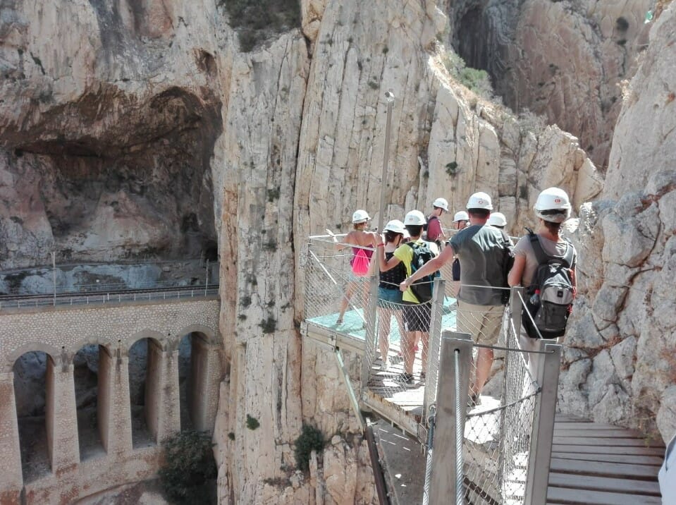
It begins on Gran Gaitán Canyon, the second gorge: 600 metres a narrow walkway running along the wall, about 100 metres in height.
And there’s the Glass Viewpoint, a balcony with glass floor through which you can see everything below you. It’s the most photographed spot on the route.
Don’t leave without looking down – but not at the river: to the old concrete footbridge, which is still there, right beneath the new one. It is the route that earned it the reputation as the most dangerous in the world. We discuss it in Is the Caminito del Rey dangerous?.
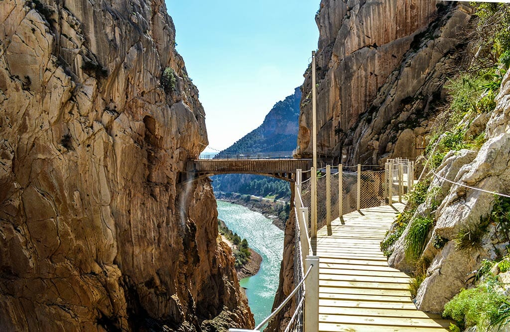
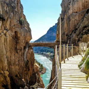
The main course. 32 metres long and 105 metres high, crossing the Gaitanes Gorge from one side to the other.
It sways a bit as you walk past. And as it’s a one-way street, there’s no option to turn round.
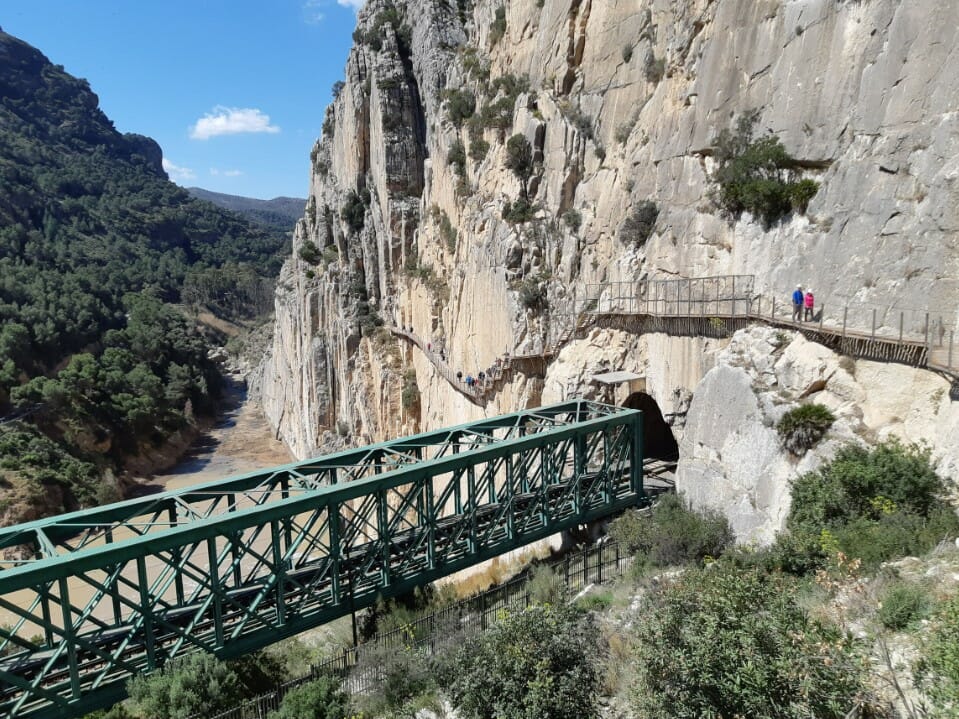
Once past the bridge, the gorge opens out onto the El Chorro reservoir and you go down the stairs to the south entrance.
At the start: kiosk for return the helmet, toilets, and food and drink stalls.
And here’s a handy tip to finish with: a 300 metres are El Chorro railway station and the shuttle bus stop, which is how you get back to the northern entrance. It costs €2.50 and you can only pay in cash: Take it with you, as there’s no cash machine there.
El Caminito was in the running for UNESCO World Heritage as hydroelectric industrial heritage, with a list of candidates that includes seven landmarks in less than 20 kilometres: as well as the dams, the footbridges and the railway station, there are the the Palaeolithic cave at Ardalesthe the prehistoric necropolis of Las Aguilillas and the Mozarabic cave church of Bobastro.
If you’re staying in the area, you’ve got What to see in Ardales. And if you want real height, the via ferrata at El Chorro.
We are a local tour operator based in Málaga with over 50 years’ experience organising trips around Andalusia. We have guided tours in various languages and the full day trip including transport:
Also available in German, French and Italian, if you’re travelling with people who prefer it.
Before you go, have a quick look the recommendations, and if you’re travelling with your family, El Caminito with children. For lunch, Where to eat in El Caminito.
A set comprising a table, benches and an armchair, all carved from stone, was placed next to the dam so that Alfonso XIII could sign the certificate marking the completion of the works on 21 May 1921. It is not a natural formation, as is sometimes claimed. During the Civil War, it was thrown into the reservoir, but years later it was recovered and returned to its original location.
It is named after its builder’s noble title. The engineer Rafael Benjumea oversaw the construction work between 1914 and 1921, and Alfonso XIII appointed him Count of Guadalhorce on 12 September 1921, four months after the dam was inaugurated. The reservoir was given this name in 1953, by decision of the Ministry of Public Works, in his memory.
In the Gran Gaitán Gorge, the second gorge on the route, now in its final section. It is a glass-floored viewing platform from which you can see the drop below your feet, at a height of around 100 metres, and it is the most photographed spot on the route. From there, you can also see the old concrete footbridge, which has been preserved just below the current one.
It is 32 metres long and crosses the Gaitanes Gorge at a height of 105 metres above the riverbed. It sways slightly as you cross it and is the most impressive section of the entire route. As it is a one-way walk, once you have set off there is no turning back.
It was not built as a footpath, but as a service road. It was constructed between 1901 and 1905 to allow workers to access the hydroelectric power station and carry out maintenance work. An interesting fact about its construction: the engineer Rafael Benjumea hired sailors to build it, as they were the only ones accustomed to working suspended from ropes at great heights.
This is the section between the two gorges, where the path descends to ground level and crosses a valley covered in vegetation. It serves as a rest area and is the ideal spot to have a bite to eat, as stopping is not permitted on the footbridges. There you’ll find the spotted tree frog’s pond, where this amphibian is often seen, and the ruins of the Casa del Hoyo.